Saturday, January 11, 2014

Hidden Valley (Ogden, Utah)


One of the best yet lesser known hikes in the Ogden area is the trail up to Hidden Valley.  The trail is on the west face of Mount Ogden north of Taylor Canyon and directly south of Ogden Canyon.  The trail begins at the 22nd street trailhead.  In this area, there are many winding trails around the foothills, including portions of the Bonneville Shoreline Trail, the Indian Trail, and a trail that heads north to Rainbow Gardens at the mouth of Ogden Canyon.  To make your way up to Hidden Valley, you want to start by following the Indian Trail.

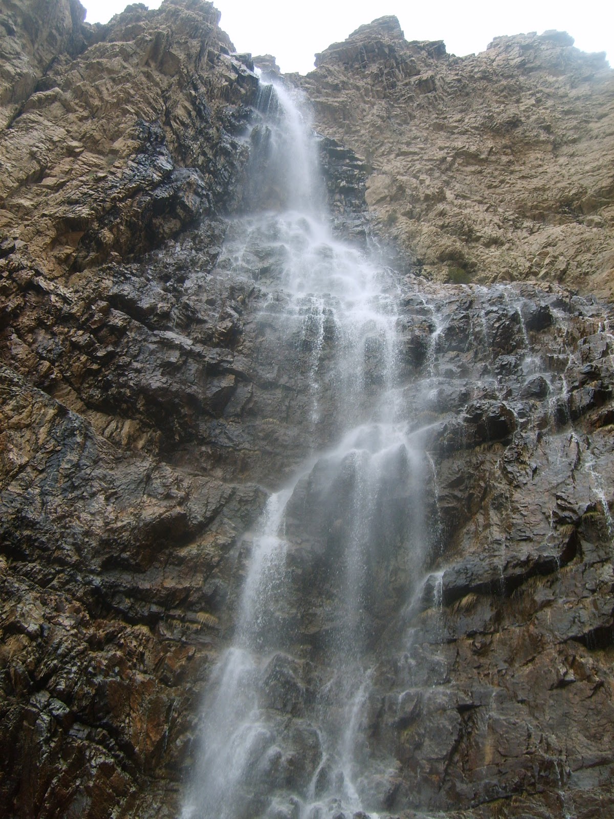
The Indian Trail makes its way northeast along the foothills of Mount Ogden and winds to towards the mouth of Ogden Canyon.  As you ascend up above the City you can look down and see the cars heading into the canyon along 12th street near Rainbow Gardens.  Far below, you can also see the  flume the crosses the mouth of the canyon and the man-made waterfall that cascades down the north wall of the canyon just past the flume.


The beginning of the Hidden Valley Trail.
The Indian Trail was originally used by the Shoshone Indians that lived in the Ogden area to make their way up Ogden Canyon.  Before the road was cut out, the steep canyon was basically impassible.  The trail hugs the canyon wall high above the river.  If you follow it for its entire length, it will make its way east around the back side of a peak on the south side of the canyon, and then it will travel down Coldwater Canyon before ending at the trailhead in Ogden Canyon near the Smokey the Bear sign.

However, after about XX mile from the beginning of the trail, you will come to another trail that breaks off sharply to the south (right if you are going up the trail from the 22nd Street Trailhead).  If you're not looking for it, you could easily miss it.  The trail is steep, rocky, and almost looks like it is just another deer path. However, this break-off trail is actually the beginning of the Hidden Valley Trail.


After ascending quickly for about 100 yards, the trail flattens out again for a while, and you are treated to your first scenic overlook of Ogden.  It won't be the last!

The trail then goes through a pair of switchbacks before winding to the east into a canyon.  There is a bit of slippery shale on the trail as it makes its way east before entering a thick grove of Douglas Firs and quaking aspen.  At this point, the trail turns again to the south.  As you hike through the thick trees, the trail becomes steeper, and you will ascend two or three very steep inclines during this wooded portion.  

Through the breaks in the trees you will see an outcropping of rock ahead to the south.  When you finally make it out of the trees, you will come up to this flat area that many familiar with this trail call the "Halfway Point".  This is a good point to take a break, and many hikers who don't want to make the entire trek up to Hidden Valley choose to turn around here.   The view (see the photo below) is incredible!
View of Ogden from the "Half-Way Point".

Those who decide to push on, however, still have quite an ascent ahead of them.  Beyond the half-way point, the trail turns east again.  The original trail went several hundred yards up a very steep grade composed of loose dirt and rocks.  You almost couldn't get up this section of the trail without using your hands to help pull you up.  A few years ago, this section was blocked off and a new, long sweeping switchback was opened in order to bypass it.  It takes longer to hike up this new switchback, but it's much easier and definitely safer than the old trail was. 

After the new switchback rejoins the old trail, you will enter yet another stand of thick trees and start heading south once again.  Much like the first heavily vegetated portion of the trail, this alternates between very steep sections and short reprieves.  This section is much longer than the first vegetated section, and it is usually around here that you start to wonder if this trail is really worth it.  Also, if you hike this trail too early in the Spring, you may find the trail covered in snow, which can make for a very difficult ascent if you don't have the proper gear.

Much like the last vegetated section, the trail finally comes out on top of another rocky outcropping.  At this point, the trail again turns east, and now you (finally) start to head into the Hidden Valley itself.  The photo below shows the view looking back toward Ogden from the last portion of the trail before you enter the valley.

Looking back to the west from the entrance of the Hidden Valley.

At this point, the trail becomes MUCH friendlier; almost completely level.  As soon as you enter the valley, you will find yourself in the thickest forest thus far.  Douglas Firs and aspen again dominate the vegetation, but there are some Spruces and plenty of Junipers around as well.  When I hiked this trail in May of 2012, it had snowed lightly the day before.  There wasn't any snow on the trail itself, but when I got into the valley many of the tree branches were still dusted.

Trees lightly dusted with snow in Hidden Valley.
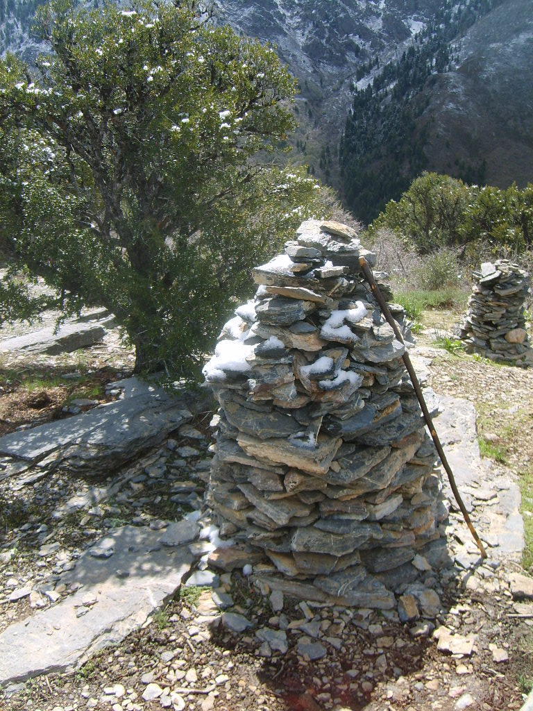
Huge Rock Cairns mark the end of the trail!

After making your way through the valley for about a quarter mile or so, the trail will again curve to the south and you will start to ascend again, one more time.  The trail is not steep, but you still have almost 1/3 of a mile to go.  You will pass plenty of vegeaataion, and plenty of excellent looking campsites before finally you will come out of the trees onto the north rim of Taylor Canyon.  One of the largest rock cairns you (or at least I) have ever seen marks the end of the trail.

In this photo (taken 2012) there were actually two cairns.  Both the year before and the year after there was only one... I am curious to find out what will be there in 2014.
The real reward for making this journey through the Hidden Valley is the view of Allen Peak and Mt. Ogden across Taylor Canyon.   Allen Peak is the prominent peak in the photo below.  Mt. Ogden is slightly higher, but from this perspective doesn't look as tall.  You can see Mt. Ogden slightly below and to the right of Allen Peak.  The Downhill Skiing events in the 2002 Winter Olympics were held right on the other side of the peak you can see from here.

I have very seldom had to share this overlook with other hikers.  The trail isn't very well known, so if you're looking for solitude, this is a great place to find it.  The sounds are as incredible as the view; if you get there early enough in the springtime, you can hear the rushing runoff of Taylor Creek in the canyon far below.


Trail Stats:
Trail Type:                  Out-and-back
Total Length:               4.9 miles
Total Vertical Feet:      2,100
Average Slope:            16.1%

Sunday, April 7, 2013

Malan's Peak (Ogden, Utah)


Malan's Peak is one my favorite trails in the Ogden area.  Malan's Peak is a sub-peak of Mount Ogden and is situated between Taylor Canyon on the north and Waterfall Canyon on the south. Like the Waterfall Canyon trail, this trail begins at the 29th street trailhead.  The trail winds up Taylor Canyon before ascending quickly up a series of long switchbacks that lead to the top of Malan's Peak.


From the base of the trail you can see the peak.  This photo is actually from partway up the trail, and from the base the peak looks pretty daunting.  At the trailhead you can't even see Mount Ogden Peak, and Malan's Peak actually looks like the top of the mountain.  From the trailhead, the trail makes a quick steep climb up to the Bonneville Shoreline Trail.  Heading north along the Bonneville Shoreline from that point, the trail gradually climbs as it winds to the northeast into Taylor Canyon.  


After about a mile, the trail meets the stream coming out of the canyon. The path ahead is rocky, but not too steep as it follows the stream bed for about another half mile.  There are a couple of places where the trail comes close to the stream and the trail flattens out.  The spot above is one of my favorite places to take a quick breather on the hike.


The trail gets rockier as you get higher up.  After about a half mile, the trail passes an area where the dirt on the hill across the stream must contain a lot of sulfur because it is bright yellow in color.  Not far beyond that, you reach this foot bridge.  This is the marker for the first real switchback where the trail crosses the stream, curves sharply to the right, and begins to go west.


The next leg of the trail is what I like to call the "Death March".  It is about a half mile long and has a constant slope of about 18 degrees.  This photo shows one of the steeper sections of the trail.  You start to gain elevation pretty quickly here.


 If you stop at the point where I took the photo above and look back, this is what you see.  There is a section of granite cliff that sticks out into the trail and looks pretty cool.


The next switchback is longer than the first and it's still very steep.  It's probably just as tough as the previous leg, but for some reason it doesn't seem quite as tough.  Not long into this switch the trail enters into a thick Douglas Fir forest, and it never really comes out of it again until you get to the top.  Near the top of this switchback (and right before the very steepest part) is the log in the photo above.  This is another of my favorite spots to take a rest and look back at how far I've come.


Above the log is another switchback that is much shorter, only about 1/8 of mile for the next two legs.  After that, the trail curves to the south and slowly works along the edge of a forested ravine that drops off on the left (east) side of the trail.  I've seen moose in this area more than once.  

After following the ravine the trail curves back to the west and begins to make the final run to the top.  The Douglas Firs begin to give way to scrub oak and smaller maples, and the trail narrows up but stays well-defined.


Finally, the trail emerges on top of a knoll and you can walk out onto the peak itself.  The view of Ogden 2800' below is amazing, and you can see for a long distance both north and south.  Looking back to the east gives you perspective on just how far away Mount Ogden really is -- from the top of Malan's Peak it doesn't look a whole lot closer than it does from the valley floor.


Looking north from the peak is a pretty neat vista-- you can see a cascade of three mountains, one behind the other.  The nearest is the spur of Mount Ogden that contains the Hidden Valley trail on the far side of Taylor Canyon.  Beyond that you can see Lewis Peak and finally Ben Lomond, furthest away to the north.

To the south, the trail continues into Malan's Basin and onward up toward Mount Ogden.  If you keep going south, you can make your way down into Waterfall Canyon, however if you want to combine the two trails I recommend doing it the other way around since the area of shale/scramble above Waterfall Canyon is pretty steep and would be much easier to go up than down.


Trail Stats:
Trail Type:                   Out-and-back
Total Length:              5.6 miles
Total Vertical Feet:  2,200
Average Slope:            14.9%

Saturday, April 6, 2013

Waterfall Canyon (Ogden, Utah)

Waterfall Canyon (Ogden, Utah)

Ah, Waterfall Canyon!  Everyone who has ever been in the Boy Scouts anywhere in Weber County, Utah has done this hike at least once.  A fairly short yet fairly steep hike, this little trek takes about 2 hours total and leads to a very pretty waterfall.  It remains one of the most popular hikes in the Ogden area and the trail is very heavily used.  This is a good hike for kids that are about 6 years and up (as long as they like to hike .... the upper part of the hike can be tricky if you're trying to carry kids around!).  My daughter loves this hike and always asks when we can do it again.

The trail begins at the 29th street trailhead in Ogden.  This is the same take-off point for anyone wanting to hike to Malan's Peak or Malan's Basin.  The trail starts out by taking a couple of steep bends up to hit the Bonneville Shoreline Trail (which traverses along the base of the Wasatch Mountains in various segments from Brigham City to Provo).  Once on the trail, you head south along the Bonneville Shoreline for about a half mile or so.  


Smiley Face Water Tank!
You know you're getting near the mouth of the canyon when you run into a couple of old rusty water tanks just below the trail on the west side.  I call the tank on the north side the "smiley tank" because someone has painted a huge yellow smiley face on the top of it.  It's a bit hard to tell what it is from the photo above, but if you look at any recent aerial photos of the area it's a dead giveaway.


Just beyond the smiley tanks the trail curves to the left and heads east into the canyon itself.  The next half mile or so is pretty steep but the trail is good.  Up to this point, the vegetation has been pretty open, with mostly sagebrush and scrub oak around.  As you head into the canyon, the vegetation remains sparse and open, but as you can see from the photo above it thickens up pretty quickly.  At this point in the trail, you can hear the stream from the waterfall, but it is far below in a ravine on the south side of the trail.


Rocks and Trees in Waterfall Canyon

After about a half mile, the trail and stream come together.  At this point, you truly enter the forest and the trail becomes more irregular and rocky.  The trail crosses back and forth over the stream a couple of times and continues to climb rapidly as you get deeper into the canyon.


I've always liked this rock.  You hit it about halfway up the canyon.  It sits high on the cliff on the north side, and always looks like it's about ready to fall right off the side of the hill.


The further into the canyon you go, the steeper and rockier the terrain becomes.  More deadwood begins to be piled up in the stream beds, and you start to see a lot of "mini-waterfalls" all along the way.  About the time you get to this point, you can start to hear the main waterfall off in the distance.


And before you know it, you're there!  The waterfall cascades down over hundreds of feet of rock, lands in a pool, and heads down the canyon.  The area around the waterfall itself is the steepest terrain of the entire hike; it's a bit tricky to find a good spot to sit.  The views are incredible, though, and it is definitely worth the trek up the canyon. 

The area around the waterfall is shaped like a big semicircle with cliffs on the north, east and south sides, and the trail you came up on the west.  The waterfall runs down the cliffs to the north, and the ground in the circle is angled at about a 20% slope running from southeast to northwest.  The ground is shale-covered, and footing can be a bit tricky, especially for very young kids.  

Optional Combination with Malan's Peak Trail:  At the very top of the circle (in the southeast corner), there is a small break in the cliffs that you can climb through.  From here you can make your way around to the top of the cliff, up above the crest of the waterfall, and into Malan's Basin.   If you go this way, I don't recommend taking kids younger than eight or ten with you because the terrain gets very steep and there is no trail.   

Once you make it up into Malan's basin, you will quickly find the trail that leads back around to the top of Malan's Peak.  From there, you can head down the Malan's Peak trail which will lead you back to the 29th street trailhead in the opposite direction from where you started.  This combo trail is a lot of fun, and I've done it three or four times in the past.  However, if you do plan to combine the trails, I would highly recommend you go up Waterfall Canyon and down Malan's Peak, and not the other way around since the steep shale areas above Waterfall Canyon would prove very tricky to negotiate coming down.


Trail Stats:
Trail Type:                   Out-and-back
Total Length:              2.6 miles
Total Vertical Feet:  1,100
Average Slope:            16.3%

Peekaboo Loop Trail (Bryce Canyon NP)

Peekaboo Loop Trail at Bryce Canyon NP

I'm going to give the Peekaboo Loop Trail in Bryce Canyon my first review since I'm using a photo I took along that trail as the banner for this blog.  Simply put, the Peekaboo Loop Trail is absolutely my favorite trail in Bryce Canyon, and probably ranks in my top 3 overall.  This is a trail that I had wanted to hike for several years, yet due to one circumstance or another, it had eluded me each time I made the visit to Bryce Canyon.

That changed in May of 2012 when I spent the week at Ruby's Inn for the annual UGIC (Utah Geographic Information Council) Conference.  On a Wednesday afternoon, I managed to sneak in a solitary hike, and it was fabulous.  

The trail starts at Sunset Point, the most crowded and popular point in the entire park.  I had trouble finding a spot to park, and finally managed to squeeze into a small spot that nobody else wanted to try and fit into.  The area was crowded, even for mid-May, but that was soon to change once I hit the trail.  

As you can tell from the map above, the Peekaboo Loop trail is shaped like a big figure 8.  From Sunset Point, the trail follows the heavily-traveled Navajo Loop trail for the first .7 or .8 miles (depending on which half of the loop you take).  

Thor's Hammer


I took the eastern side of the loop down into the canyon.  The trail quickly switchbacks its way down, and you lose several hundred feet in a very short distance.  However, this is a very popular part of the park for a reason--some of the most amazing features in the park can be found along the 1 1/2 mile Navajo Trail Loop.  

Among the hoodoos (that's what they call all of the rock spires you find in Bryce Canyon) along the Navajo loop is perhaps the most famous of them all - Thor's Hammer.  The Hammer sits silently just 200 vertical feet or so below the trailhead, and many people who never venture beyond the overlook above miss out on this amazing formation.  The photo to the left simply doesn't do it justice -- it is amazing to see how such a fragile pinnacle made of sandstone continues to endure.  This is one of those features (along with Landscape Arch in Arches NP) that, whenever I see it, I always wonder if it will still be there the next time I visit.

After dropping down more steep switchbacks into the bottom of the canyon, you can either follow the other side of the Navajo loop back up to Sunset Point or continue south and take the trail less traveled.  If you do, the crowds quickly disappear and you  

Looking Back toward Sunset Point

soon find yourself crossing the bottom of Bryce Canyon proper and making your way toward the hill to the south.  As I started up this hill, I came to the second split that began the lower half of the "figure 8".  I again took the east half of the loop and worked my way up the steep hill. As I neared the top, I looked back to see Sunset Point off in the distance.

Dropping down off the north side of the hill, the trail passes the "fairy castle" (the photo I used for the banner of this website) and slowly winds in and out of canyons and hoodoos until it comes to the bottom of the figure 8.  At this point, you have the choice to continue on the with the loop, or take the trail straight south up to Bryce Point and catch a shuttle back to your car.  

I love the picture to the right.  Bryce point is the tiny lookout on top of the cliffs you can see high above in the background of the photo.  1 mile to Bryce Point, and about 1000 feet straight up!  Good luck with that.  To be fair, I had probably dropped about 800-900 feet coming off of  Sunset Point, but the trek back up to Sunset just didn't seem as daunting.

After continuing on to the west side of the loop, I quickly arrived at one of the most scenic areas of the hike: the "Wall of Windows".


The Wall of Windows
The Wall of Windows is a thousand foot-high fin of sandstone rock that has worn thin enough in places to have several "windows" open up.  They are really just fancy arches, but they are incredible, they are really big, and they are really high up there.  Once again, photos don't do them justice.  As I stood and looked at these majestic formations, I was all alone, it was completely silent -- just me and nature.  I tried to hear the sound of anything else -- another human, a car, but nothing.  It was pretty amazing.

Ponderosa Pines and Douglas Firs in the Canyon
 Once past the wall, the trail winds up and down over a couple more hills, and then begins to ascend toward the high point of the trail's west side.

The photo to the left shows the trail I had just come up.  Notice the trees growing in the narrow pass.  One of the amazing things about Bryce Canyon that many who haven't visited it don't realize is that the park has an elevation of 7000'-9000' above sea level.  Geologically speaking, Bryce Canyon is situated at the very top of the Grand Staircase in the Pink Cliffs of the Claron formation.  The Paunsaugunt Plateau that makes up the part of the park above the canyon rim is thickly forested with Douglas Firs and Ponderosa Pines, something that people often don't associate with the "deserts" of southern Utah.

Heading into the Tunnel
Another thing that I really enjoy about the canyons of southern Utah, and particularly about Bryce Canyon, is the contrast of the  red rock against the green vegetation and the blue sky.  There are few other places in the World that resemble these canyons, and I feel lucky each time I get to see them.

At the top of the narrow switchbacks, a small platform has been built out of sandstone bricks to flatten the path out into a tunnel that goes directly through the wall of the canyon.

The tunnel itself is about six feet wide, ten feet high, and about fifteen or twenty feet long.  There are several tunnels like this on various trails throughout Bryce Canyon, but this is one of the longer ones that I have found.

Once inside, the exit to the tunnel frames the formations to the north, including "Boat Mesa", the large plateau that you can see off in the distance to the right of the tree in the photo below.

Once out of the tunnel, the trail drops and ascends one more time, again taking you through amazing formations on both sides.

Another unique feature of the Peekaboo trail is that it is a shared hiking/horseback trail; really the only one in the park that allows both foot traffic and horseback tours.  They even have a horse corral near the split-off to Bryce Point.  Near this tunnel there were several people coming through on a horse tour and I had to wait while they passed me by.  It was interesting, because I think I saw more people on horses than on foot while on this trail.  The solitude you experience here is one of the best parts of the Peekaboo Loop.
Looking through the Tunnel


Peekaboo Canyon
At the top of the next rise is a narrow crack through the next fin that serves as the namesake for this trail -- Peekaboo Canyon.  It's only about 30 feet long, but it's about as narrow as the tunnel I passed through earlier.  I think the reason they call it "Peekaboo Canyon" is because as you exit it the "Silent City" formation suddenly appears in front of you off in the distance.  The "Silent City" is probably the most famous formation in all of Bryce Canyon.  This is the scene that can be scene from the Inspiration Point overlook -- high above to the North-- and is often printed all over Bryce Canyon posters and postcards.

Above the Silent City is Sunset Point, which comes into view again for the first time since passing the Fairy Castle area on the east side of the loop.  You can see the point where the trail both started and ends off in the distance.  The next stretch of trail is a long, gradual descent back into the bottom of Bryce Canyon proper which marks the middle section of the big figure 8.  Near the bottom of the descent, the trail comes back to meet the point where I had split off a little earlier, and I knew the bottom loop was complete.


Bristlecone Pine


Along the descent there was still plenty of great scenery.    In addition to the Silent City across the canyon, I passed several Bristlecone Pine trees on the way. Bristlecone Pines can live up to 5000 years, and they are currently the oldest living plants on the Earth (that have been discovered, anyway).  

This guy was just hanging out on the side of the hill all by himself -- it makes me wonder how long it's been around.  The tree had several branches that had dried out and died, and the gnarled roots have been exposed by erosion, yet it hangs on.  

After dropping into the bottom of the canyon, I came back to the point where I left the Navajo Loop trail.  The Navajo Loop trail is amazing on it's own, and I'll have to dig up some photos of it and post them at some point. From here, I took the western path in order to really complete the figure 8.  This route is called "Wall Street" because it takes you through narrow slot canyons before heading up more than a dozen very steep switchbacks up the the trailhead at Sunset Point.

A fairly strenuous hike, but absolutely worth it.  As I said at the beginning, the Peekaboo Loop remains the favorite of the trails that I have done so far in Bryce Canyon.  In May 2013, I'm hoping to return to Bryce and do the Fairyland Loop Trail in the north section of the Park.

Trail Stats:
Trail Type:                   Loop
Total Length:              4.8 miles
Total Vertical Feet:  2,590
Average Slope:            10%

Friday, April 5, 2013

Let's Hit the Trail!

Welcome to my hiking blog!  Since I haven't updated my Mindless Rants blog in over four years, I decided it was time to start anew.  And what better way to do so than to dedicate a site to something I am very passionate about -- hiking!  

This blog will contain my photo-journal of the hikes that I go on throughout the year, and will eventually serve as a companion site to my Hiking Maps Site. As I complete hikes, I plan to post a report here along with photos, maps, and other good stuff.

To start out, however, I am going to create several posts containing general descriptions of some of my favorite hikes from across Utah and neighboring states that I've completed in the past few years.  Once those are up, the posts will follow my hiking adventures in real time.  Happy trails!